Atlas historique
de l'Antiquité tardivé " L'Antiquité tardive est la période de l'Histoire couvrant la fin des Empires romain et sassanide, la formation des royaumes
barbares en Occident, la transformation de l'Empire romain d'Orient en
Empire byzantin et la première expansion musulmane. C'est la fin
de l'Antiquité et le début du haut Moyen Âge. Jadis
méconnue, elle fait aujourd'hui l'objet d'une attention particulière.
Ce site a pour but d'offrir des repères utiles à la compréhension de la géopolitique complexe de cette époque."
Osshe Historical &
Cultural Atlas Resource "This project was designed to provide
a corpus of material for use by faculty in many fields and on many campuses
within the OSSHE system to enhance the learning experience for students.
Developed cooperatively between the University of Oregon Department of
History, UO New Media Center and Department of Geography InfoGraphics Lab.
All of the atlas resources contained in this site are original materials
produced for this project."
Interactive Ancient Mediterranean "IAM is an on-line atlas of the ancient Mediterranean world designed to serve the needs and interests of students and teachers in high school, community college and university courses in classics, ancient history, geography, archaeology and related fields."
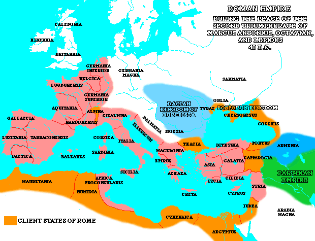
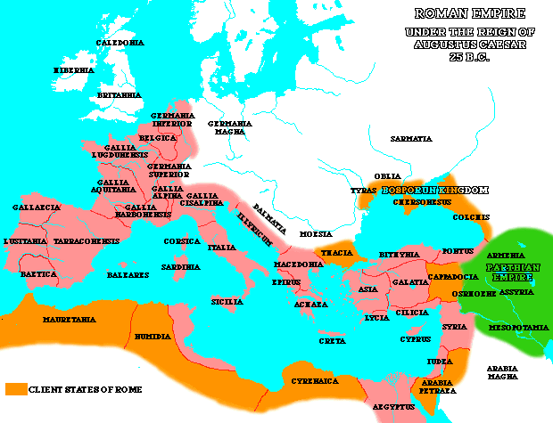
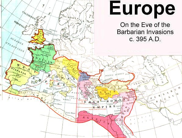
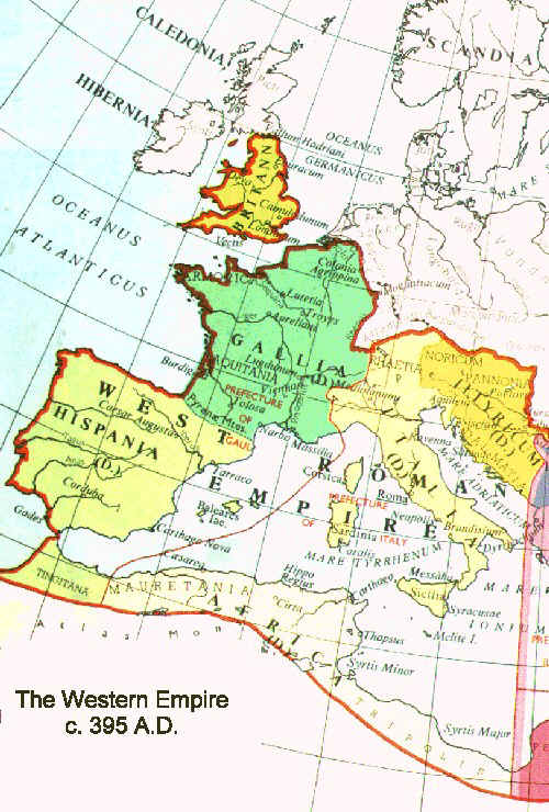
18 centuries of Roman Empire
"The centrepiece of this web site is a series of 19 maps of the Roman Empire, roughly every century, from its beginning in 338 BC to its end almost 18 centuries later, with commentaries"
Maps of Ancient Warfare Twenty two maps and figures relating to Greek and Roman warfare courtesy of The Department of History at the United States Military Academy.
2nd Punic War Excerpted from Osshe Historical &Cultural Atlas Resource. Requires shockwave.
2nd Punic War Excerpted from Osshe Historical &Cultural Atlas Resource.
The Roman Empire in I-III century AD Every section is a GIF-image supplied with overlaid texts. Because of the communication restrictions over the Internet the number of colours is reduced to minimum and images are not antialiased. Included are the following sections: Britain, Gaul, Germania, Raetia and Noricum, Italy, Sicily, Sardinia and Corsica, Spain, Danubian provinces, Greece, Asia Proconsularis, and Thracia, Pontus Euxinus and Asia Minor (except the province of Asia), Syria, Palestine, Arabia, Egypt and Cyrene and Northwest Africa. Excerpted from Roman Empire-Seedbed of Christianity
Rome and Romania, 27 BC-1453 AD Twenty-seven maps of Rome and the Roman Empire from 116 AD to 1328.Copyright (c) 1996, 1998, 1999 Kelley L. Ross, Ph.D. All Rights Reserved.
The Roman EmpireInteractive map searchable by Provinces, Territories, Tribes,
Towns, Cities and Barbarian Incursions. Courtesy of the Illustrated History of the Roman Empire.
Roman Frontier Excerpted from Osshe Historical &Cultural Atlas Resource. Requires shockwave.
Roman Maps and the Concept of Indian Gems "The two maps discussed here are Ptolemy's mid-second century map of India (Stevenson 1991) and the apparent third century
Tabula Peutingeriana or Peutinger Table."
Roman ItalyInteractive map searchable by Areas, Regions, Tribes,Towns and Cities, Rivers, Lakes, Mountains, etc. Courtesy of the Illustrated History of the Roman Empire.
The On-line Encyclopedia of the Roman Provinces
"A new reference work coming on-line this summer.Ę For advance information contact Clayton Miles Lehmann. Preliminary versions of the following provinces are available now."
La Maquette de Rome
Model of Rome as it was under Constantine in AD 320. The model is 180 cm X 180 cm, at a scale of: 1:1800. The site is in French with an English translation available. ourtesy of AndrŽ Caron, QuŽbec.